Saturday 9 October 2010

Runkeeper maps and route profiles added

I've added at the end of each date the route I took and the approximate statistics - elevation, speed etc.

Clicking in the top left hand corner of these images (view details at runkeeper.com) should take you to further information as shown below for 25 September where I climbed a total of 1.36km and cycled 161km.
From Screen Captures

Wednesday 6 October 2010

Finished - 955 miles; summary, some list and miscellaneous figures!

I certainly didn't come first in any speed challenge but I have enjoyed myself!
I set out with some Goals, these were to:
  1. cycle from Orkney back to Kent before my son's 15th birthday; done with time to spare!
  2. look at engineering works to show how great examples of both current and historical engineering works are all around us and help to make our country the success it is; I believe I had a good go at this and whilst I could have done more, some people found it a little too technical!
  3. visit my family across the country; well I managed to visit my parents, brothers and sister and most of their children. Thank you for putting up with me and my thoughts are very much with my brother Angus who shortly after I met up with him and Robert had an accident and has yet to recover.
  4. reflect on the implications of the big changes I (and perhaps we all) need to make as we move to a low carbon economy; well I have done this but reached no firm conclusions. I will return to this on another blog.
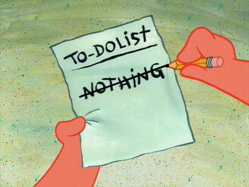
    • There's always something to do...
    • raise money for two charities; I still have a bit of work to do on this but I am extremely grateful for all those who sponsored me - thank you
    • find a new and challenging permanent job; still working on this one but the notice period I have been given related to my redundancy goes through to mid-February, so there is till time!
    _________________________________________________________________________
    So I thought I would round up with some lists
    Challenge favourites 
        1 cycling with Angus and Robert from Hexham
        2 south from Tongue to Lairg with pint in the Crask Inn
        3 05:30 start from Kirkwall to catch ferry from St Margaret's Hope 
        4  getting new wheel in York!
        5  staying with and meeting nearly all my family at various places along the route  
    Places that catered for my cycling best 
        1 London (quantity, maps, clear route types, investment)
        2 Loughborough (junctions, quality and quantity)
        3 York (cycling facilities)
        4 Inverness and area around south to Aviemore (old A9 and commuting)
        5 Sheffield (plus whole region from Derby to Market Harborough)
    Places that catered for my cycling least 
        1 Leighton Buzzard to St Albans (signs, routing etc)
        2 Milton Keynes (signage misleading and quality of surface)
        3 Peterlee plus or minus 10 miles (quality of NCN route 1 surface)
        4 Edinburgh (RR - ring road was very poor quality routing, poor junction design, no temporary routing whilst roadworks taking place). Of course this is where I was born so I should favour it!
        5 Perth (no idea what is going on at junctions)   
    Numbers
        £2,637.10 raised to 6 October; £1,400 to go, it's never too late and every little helps! Thank you. 
        955 miles (1,635 km) cycled including about 1 mile walked (some hills, tunnels and foot bridges)
        356 photos taken
        20 blogs written (almost daily)
        9 kilometres (5.6 miles, 29,600 ft, 9,031m) total vertical climb
        8 serious near misses; incl. 2 by me (skidding on wet rivets on old rail bridge and narrowly missing curb, 6 by others - 1) head-on young guy racing level crossing barrier closing from side road near Doncaster, 2-5) local coach in Derbyshire, HGVs near Perth, St Albans and Woolwich having no idea what they were doing! 6) 50+ year old woman driving in Tain where shopping is far more important than watching the road. General knowledge of Highway code rules 139, 158 and 188 fairly poor with at least 1:100 drivers - at least the time I met them!
        1 new rear wheel but no punctures
    Slideshow of all photos as per map above 

    Tuesday 5 October 2010

    Day 20 : Flamstead to Chatham, 68 miles, wet start to dry and overcast

    Well I may have got a good night's rest but the weather was no better in the morning. Despite my best efforts, substantial 'as much as you can eat breakfast at 7am etc, I didn't get away until just before 8am. This was probably a good time to go with hindsight as I suspect that HGVs avoid the rush hour journey along the A5 into St Albans.
    Notwithstanding that the journey all the way to Barnet on A5 via St Albans (nice but didn't look around much), Colney, M25 junctions 22 and 23 via Blackhorse Lane, South Mimms certainly got me close to certain good and poor aspects of highways design.
    London Cycling Guides - these are really excellent and are available free on line from tfl.gov.uk
    However, once in Barnet the excellent and free London Cycling Guide map series (I had carried the four relevant ones with me all the way) came into their own. They are absolutely superb, although I could have protected them better from the rain, and I enjoyed the whole way back from there on in. Routes are colour coded to one of six types and I easily followed yellow routes (quieter roads recommended for cyclist although not necessarily signed) all the way to Tottenham Hale. This is the current link to order cycle guides on line.
    The point at which I reached Route 1 (this is the route that goes through Kirkwall, hugs the east coast and passes our house enroute to Sandwich/Dover). The path follows towpath to west of the River Lee Navigation from Stonebridge Locks, however as there was only one arrow on the post it was not at all clear!
    Route 1 takes a little diversion across this footbridge and then around Hackney Marshes. It is completely unnecessary, today it required a splash through 300mm of water and a trek across muddy playing fields just to get to the same canal towpath I was on already! I wasn't very impressed with myself for not noticing that on the TfL cycle guides.
    First sight of Isle of Dogs
    I passed by the Olympic site and into Mile End.
    After turning west away from the Hackney Cut of the River Lee Navigation and along side the Hertford Union Canal, the route took me through Victoria Park and then south through Mile End Park, between Mile End and Limehouse. I have to admit not being at aware of the existance of the very pleasant series of parks. On leaving the park, I almost made a fateful mistake on turning right on CS3, Cycle Superhighway 3, which although it was clearly signposted to Tower Gateway did look very inviting!


    Millwall Inner Dock from Pepper Street towards One Canada Square
    Not a great photo but the route 1 takes lifts up and down from the pedestrian tunnel (designed by Sir Alexander Binnie). Built from 1899 to 1902 it replaced an sometimes unreliable ferry service. The southern tunnel entrance in Cutty Sark Square. The tunnels and their staircases are currently be refurbished as it the Cutty Sark (out of shot but behind me!). A quick pit-stop to buy lunch of sandwich, fruit, Eccles cakes and orange juice from M&S and I was straight back on the road. I'd divided today into 5 sections of 20km each and Greenwich was the end of section three. I knew I had to keep moving!
    Several hundred extras being allowed to cross Romney Road for a the next of the Pirates of Caribbean films, On  Stranger Tides (due for release in 2011) part of which is being shot near Greenwich Park and the National Maritime Museum (thanks for the help on this one - see comments and this link). The characters looks very believable to me!
    I took route 18 to Woolwich which was a safe and easy ride at this time of day
    Looking upstream back towards Canary Wharf and O2 Dome with Thames Barrier in the foreground. Route 1 joins the path alongside the River Thames for the next 10 miles (apart from a short break at Erith) when it turns inland to follow the River Darent and Crayford Creeks into Dartford.
    According to its Wikipedia entry the Thames Barrier started construction in 1974 and although largely finished in 1982 was not officially opened until 1984. The concept of the rotating gates was devised by Charles Draper. The barrier was designed by Rendel, Palmer and Tritton for the Greater London Council and tested at HR Wallingford Ltd. The site at Woolwich was chosen because of the relative straightness of the banks, and because the underlying river chalk was strong enough to support the barrier. It is the world's second largest movable flood barrier (after the Oosterscheldekering in the Netherlands)
    Some of the Grade I and II listed buildings in the Royal Arsenal Development. Over 3,000 people now live on the coverted Royal Ordnance Factory site (closed in 1967). Plans have now been submitted for a new masterplan encompassing further land along the river. The new plans incorporate a further 1,200 new homes, along with 270,000 sq ft (25,000 m2) of commercial, retail, leisure space and a 120-bedroom hotel. Also included in the plans is the new Woolwich Crossrail station, which has been part-funded by Berkeley Homes.
    The cycle route continues past the Riverside Resource Recovery (RRR), energy from waste facility. According to the company's website, the Riverside Energy from Waste facility at Belvedere in the London Borough of Bexley, is Cory Environmental's single most significant development project. With an average annual capacity of 585,000 tonnes, it will be an important strategic river-served waste management facility for London, helping the capital to manage its own waste, keeping over 100,000 HGVs off the capital's congested roads each year and making a real contribution to London's ability to meet its landfill diversion targets. Looks a little like an incinerator to me.
    Dartford Salt Marshes with the Dartford River Crossing (QEII bridge, 1991) just visible in the gloom!
    Once in Dartford the route is easy and follows a dedicated path in the corridor of the A2, but away from it, after Bluewater.
    Further along the same stretch the route utilises the old A2 surface for several mile. The path meanders pleasantly with new landscaping on either side.
    Familiar local journeys suddenly didn't seem that far nor the gradients very steep at all as I rapidly found myself pedalling back over the bridge I'd started on a few weeks ago.

    Looking the other way from the way I left 20 days ago, across the bascule bridge taking me across onto St Mary's Island, Peel Port's Chatham Dockyard can be seen beyond the first basin.

    Day 19 : Northampton to Flamstead, 50 miles, wet and dull!

    Today I was intending to travel from the Hopping Hare in Dunston, on the northern outskirts of Northampton, to Waltham Abbey YHA near the M25 and the Lea Valley.
    First of all the weather was horrible and towards the end of the day a south-westerly wind was buffeting me about.
    I did know that the whole of this route was not complete and that my Sustrans route maps refer to some routes opening in 2002! However, I was not expecting quite as many alterations from the maps and missing and confusing signposts.
    Nene Whitewater Centre is an artificial (pumped) whitewater course just to the south of Northampton.NCN route 6 passes immediately adjacent to the course. According to their website (www.nenewhitewatercentre.co.uk) three pumps control the discharge of water down the 300 metre whitewater course allowing the Centre to control flow rates thereby altering the course’s difficulty and skill Levels required to paddle it. It certainly looked fun and really suitable for the weather!
    I wished I'd stayed longer watching the fun people were having at the Nene Whitewater Centre because it was after this I managed to find myself misdirected into Hardingstone and then had to find my way out of a new housing estate by a very muddy and slippery grass bridleway totally unsuited to my laden road bike. The Google street view that I have given this link for this might look alright on a dry clear day but it was wet, dark and windy. This was a fairly low point for me!!!


    The rest of the day was wet and I thought I wouldn't get out the camera very much. Milton Keynes (MK) promised a lot to start with, clear signs (perhaps a little too often) but then rapidly descended into farce as signs had either been moved for fun by locals or otherwise vandalised. I must have spent a good extra hour exploring the canals and paths of MK. The only good thing I can say is at least there were paths, overgrown and infested with tree roots they might have been! Anyway I did manage to get a way out of MK vis Fenny Stratford and the A5(T) and the A4146 towards Leighton Buzzard (LB) for a distance. looking at the map now I have no idea why anyone would ever contemplate going the way I did - especially when I see with the A5 I could have got past LB in half the time. Grrr!!
    16.00 in Stanbridge
    16.00 in Stanbridge, Bedfordshire. I'm still on route 6 at this point but realise with 33 miles on my current routing to Waltham Abbey I needed a Plan B. I was going at less than 10 mph, in strong wind and then having to navigate through lightly signposted paths around Dunstable, Luton. Welwyn Garden City and Ware I was going to reach the Plan A destination very (too) late!
    It was at this point that I noticed the A5 was the most direct route if was still going to go to Waltham Abbey or even to get to London. So I I put on extra lights and checked out reflective jacket etc and headed off down the A5. It is fair to say that my view is that trunk roads are to be avoided at all times and especially when cold, wet (with a great deal of spray) and very dull). There was some provision in places for cycling, large warning triangles, but remedial classes for those drivers who are so desperate to get where ever they are going that they have forgotten to look where they are going.
    To cut a long and tiresome story short I ended up just before the M1 at Junction 9 considering my options to keep heading south along A5 to St Albans. Then I realised I was in the rain just outside this Premier Inn which looked like a good idea at 17.30. So that where I stayed and I was so relieved. I told myself I'd be up earlier to get a good run at the whole journey back to Kent. I did sleep well. Zzzzz

    Sunday 3 October 2010

    Day 18 - short video piece


    - Day 18 travelling south from Market Harborough on the old Great Central Railway track plus a short and poor quality shot of a steam train leaving Leicester North station 

    Day 18 : Shepshed to Northampton, 56 miles, sun with cloudy intervals

    Shepsted is a small town a few miles north-west of Loughorough and I knew it was going to be a good day when I opened the curtains to see most of the rain clouds had vanished. I took route 6 all the way to the north of Northampton via Loughborough, Leicester and Market Harborough.
    Bike parked in sunshine below the bedroom - each door is an entrance to 3-4 self catering units
    Loughborough, as I had expected from its sporting reputation, was well stocked with cycling provision. The best aspect being the attention to detail in the routing of the paths especially at junctions; there are certainly other places that I'd passed through that could learn a lot here.
    There were also neat design features to make sure cyclists can join traffic flow without being run down.
    I'm not sure that I have ever been anywhere in Leicester other than stopping in a train at the main station. I realise my transit through the city was fairly superficial but I am getting the impression that from the cycle route of old canal tow paths and railway lines I do see a side of these cities that it is not seen by people in their cars or simply shopping.
    Leicester City Centre Park
    Leicester City Centre Weir on the River Soar
    Route 6 leaves Leicester to the west along the old Great Central Railway line, there is an alternative route 63 that is three miles shorter from Leicester to Market Harborough which goes due south. However, it has 11 miles less traffic free routing and the climbs are steeper or so I am led to believe!
    The ride I took was great and there was still some hard climbing from Leicester to Saddington, five miles north of Market Harborough. 
    looking towards one of the steepest climbs since the Yorkshire Moors.
    The section along the Grand Union Canal just before Market Harborough was very tranquil; I particularly liked the various bridges that peppered the route, each one with a name which I can only presume related to the land owners for whom the bridge was constructed to provide access.
    One for Jane - just to make sure she knows I hadn't forgotten Frankie!
    horses in Leicestershire
    Market Harborough market place where I had a late lunch of ham and cheese pancake followed by a lemon and sugar one. They were huge! 
    From Market Harborough to Northampton route 6 is traffic-free for 16 of the 18 miles and follows what is known as the Brampton Valley Way. This consists mostly of railway lines, including over 800m of unlit section in tunnels but also some canal tow path closer to Northampton.
    Kelmarsh Tunnel (480 meters). I got out both front lights this time and it was much easier going!
    13 miles to go and stopping to call Jane from the side of the route whilst it was still light!

    Saturday 2 October 2010

    Day 17 : Hope Valley to Shepshed, 50 miles, heavy driving rain all day

    I set off for Shepshed (4 miles NW Loughborough) after 12:30 in the hope that the rain might ease off a little and there is little to indicate in this picture quite how wet and windy it was. However, the rain did manage to get the Ryder Cup in South Wales delayed for some hours so and I'm sure that was not just because, as a Scottish newspaper put it, the event was brought by money to a river valley in South Wales!
    Nearly out of the gate! 
    ,,,,and I'm off (9 seconds later) via Calver, Baslow, Chatsworth House, Beeley, Rowsley, Matlock, Cromford, Wirkswater and Duffield to Derby
    ... another 6 seconds later on the road and I'm still trying to remember all the place names from Derby to Loughborough as I was determined not to open up any of my panniers and get everything wet.
    Whilst I have no regrets taking the route I did in the circumstances, there can be no doubt that  the A6 on a Friday in heavy rain, with showers of spray and half the road flowing like a river 10% of the time was not much fun! I was particularly pleased with myself that I cycled the whole way up the hill out of Cromford, without stopping once, on the B5023 all the way to Wirksworth. This was partly to keep me warm as I was by now soaking all the way through - the water from the road having penetrated everything from underneath!
    I took the opportunity, on the way down just after Wirksworth, to take off all my wet clothes and put new dry ones on. The icing on the cake was a £8 sheet of polythene, 'novadry' poncho that Decathlon sells for cyclists in these circumstances. It really looks awful but I had carried it  and thought that now was definitely the time to get it out. Apparently it is breathable but I think only to a point. Anyway it did the trick and I got all the way to my destination with only my feet feeling like they were in a bucket of cold water.
    The upshot of all this is that I did not stop to take any photos, or to look at the soggy frontage of Chatsworth, or the historic mills and sites of the Peak District.
    From Derby going south, I joined Route 6 and this was a real joy - 18 plus miles of canal rides seamlessly flowing into wide railway paths taking me as far as Worthington. 


    The first section of route 6 out of Derby is called the Canal Path but some of the canal into Derby has now gone. At this point, just beyond the bridge, the end of a narrowboat can be seen indicating the adjacent Trent and Mersey Canal.
    The Trent and Mersey Canal by Swarkestone Lock. The canal goes from the Bridgewater Canal, near Northwich and Sandback in the NW, across to Shardlow, where it links to the River Trent. The later point is interesting from Jane's family history as relatives of hers are Shardlows that come from this area. This bridge at Swarkestone dates from 1810 but original ones date back to the 13th century. The original river crossing marks the furthest point south reached by the Jacobite army of the Scottish Young Pretender Prince Charles Edward Stuart in 1745. There is quite a flow of water coming through the culvert just below the bridge on the far canal bank.
    The Canal path was wet but was a great ride - I expect in summer it can get very busy and as it is very narrow in places it might be difficult to travel at my 'cruising speed' of 15mph.
    I took this photo to show the care taken in marking out the route and ensuring it is suitable for horses, walkers and cyclists. This disusedrailway line was particularly wide, the bridges in particular were very noticeably wider, and it could have had more than two lines.
    Well signed, smooth and rolling country roads took me on towards Shepshed. I stayed at The Grange Courtyard which somewhat surprisingly has no front entrance and hides itself a little too discreetly behind the old red brick of the stable yard. Unfortunately, Shepshed appeared to have only one really good eating place within walking distance - a very popular, lively and fully booked Italian establishment. I dodged the numerous well lubricated gangs in the poorly lit streets to take home a huge Chinese take-away! Perhaps I now understand why the Grange Courtyard may prefer to hide itself away from sight. 
    On a day that I thought I would have no photos I do appear to have taken some, even if the last ones shows signs that my camera was already a little wet!


    Friday 1 October 2010

    Day 16 : High Melton to Hope Valley, 32 miles, brilliant sunshine and warm

    What a great day's weather I had and most of the route (even though it was fairly short) was traffic free. There was much to remind me of Yorkshire's mining and industrial past as well as a lot related to its flourishing industrial present. I followed in 62, 67 and 6 routes that brought me to Sheffield City Centre and then followed the main road out to Castleton and then took the spur off to Grindleford.
    Breakfast and the overnight at The Stables was as good quality and value as it was advertised and  the clear blue sky was a very welcome change from the previous few days!
    I haven't looked to see what the areas were like previously but for much of the way to Sheffield the surrouding areas looks like they had been reclaimed from previous industrial use.
    Approaching the Elsecar Heritage Centre - home to many interesting industrials artifacts include a Newcomen beam engine used to pump water out of Elsecar New Colliery from 1795 until 1923, when is was replaced by electric pump. 
    The cycle route up the quite steep 'Inclined Plane' whcih as the plaque explains was lain from Milton Ironworks to Elsecar Canal Basin - built c1840 and dismantled c1930 it transported 500 wagons a day. I assume it worked a little like a funicular railway with some wagons going up whilst other went down.
    Old weir and bridges on the approach into the heart of the Sheffield City. Many of the industrial units in this area were very much alive and working.
    The top - looking over Eyam Moor towards the South
    Another view from the top - showing the patchwork of field boundaries stretching far into the distance
    Cycle routes abound in the Peak District and some traffic free ones in particular were drawn to my attention by my brother and family. The High Peak Trail from near Buxton to Cromford looks great if your going downhill and The Monsal Trail which from next year should enable people to travel the whole way along this disused rail line including the tunnelled sections. I did pass by the Monsal Viaduct last night once I had arrived in Hope Valley (although not by bike) and it looks like a fantastic route to take - on another visit! 
    My brother also pointed out that there is a lot of potential for renewable energy sources, particularly small scale hydro, in the peak district. There is good advice and examples of investment made at the friends of the peak website. In particular I thought these publications of theirs were useful